
The launch of a groundbreaking new initiative provides public access to up-to-date data about Tasmania’s marine environments and activities.
Tasmania’s Marine Atlas has officially launched, bringing together data about Tasmania’s marine estate from research organisations and federal and state government agencies.
The Atlas - a free easy-to-use tool – is designed to support research and fisheries and aquaculture activities. It combines fisheries and other diverse marine-based industries information to enhance sustainable marine management. It also serves as an educational resource about the marine environment and industries in the blue economy.
Stakeholder collaboration
A strong push from the marine sector was the catalyst for the innovative mapping project, says principal investigator Dr Myriam Lacharite at the University of Tasmania (UTAS).
“The fishing sector, aquaculture researchers and fishers needed to see what was happening in the marine environment,” says Myriam.
“They wanted up-to-date information about underwater infrastructure, fishing activities and the biodiversity of marine ecosystems.
“If there's a sensitive habitat or species in a particular area that will impact on fishing activities in these areas, the Atlas pulls together these resources for quick and easy access to users,” she says.
Atlas datasets are grouped into four categories: biophysical dimension, human dimension, threats and pressures and administration.
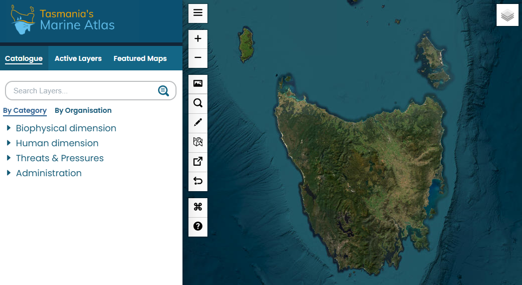
The biophysical maps include ecosystems, ocean properties, species distribution and restoration sites. Human dimension maps include commercial and recreational fishing, aquaculture, marine infrastructure and traffic, energy and research sites.
Threats and pressures incorporate climate change impacts, coastal land use, invasive species and pollution while administrative maps highlight various marine boundaries and protected areas.
Special features
A key feature that will benefit fishers is the ‘theme maps’ tool, which collates pre-defined sets of layers that are relevant to a particular topic. “For example, the ‘fisheries’ one would automatically select fisheries catch data, boundaries, etc. for quick and easy access,” explains Myriam.
“Essentially you click on fishing and then it automatically opens the Atlas onto a predefined set of layers relevant to the fishing and aquaculture sector,” explains Myriam.
The user can then select which of the related map layers they would like view. These include maps for aquaculture marine planning systems, showing marine farming zones and marine farming leases.
Publicly reported catch data is available for species managed by the Tasmanian Government. The number of species listed will continue to grow as the Atlas evolves. Broad-scale maps show where different species are caught, the intensity of fishing effort and the value of different fisheries.
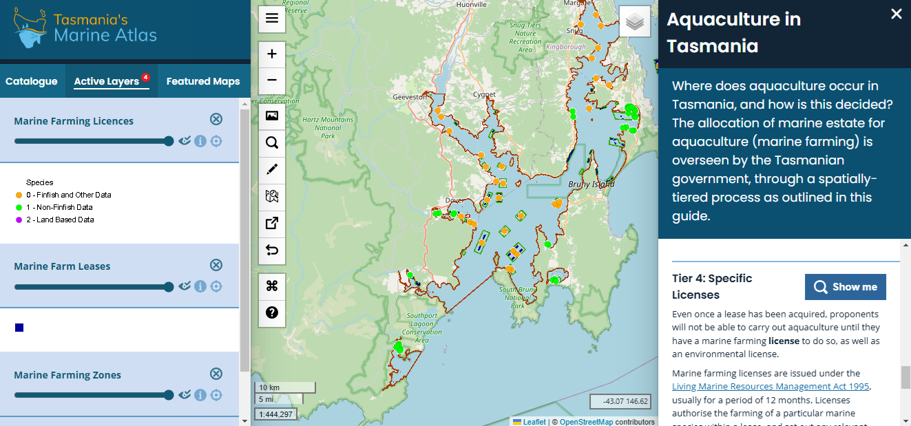
For the aquaculture sector, maps show where zones for farming different species are and where leases are.
Adding information
While the data provided on the Atlas will be useful for fishers and researchers who engage with Tasmanian waters, Myriam recognises the project faces a challenge in remaining relevant, especially in a constantly evolving ocean seascape.
“It is an ongoing challenge for the team here to make sure the information we provide in the Atlas is up to date.”
“We want to be useful to a broader range of stakeholders. And in doing so, we are also useful to the fisheries and aquaculture sector. If you want to see data hosted in the site, you are welcome to contact us.”
“More broadly, the Atlas aims to increase ocean literacy by allowing users to understand both how we interact with the environment, and how the marine environment also benefits Tasmania,” says Myriam. “One of the core ideas to support sustainability is to know what is happening.”
You can view the Atlas here.
Related FRDC Project
2019-111: Tasmania’s Marine Atlas

